
28 May 2026
Machine control systems have moved from an early-adopter specialty to a standard expectation on serious infrastructure projects, and the industry is now entering a more substantial growth phase. Three forces are pulling the market forward together: rapid advances in on-machine automation, mature high-precision GNSS technology, and digital construction workflows that finally connect design models to physical earthwork. The result is a job site in which the grader, the excavator, and the dozer are no longer isolated tools but live nodes in a single data network. This article looks at where that shift is heading, what it requires of the systems that sit on the machine, and how CHC Navigation is positioning its machine control lineup for the next phase.
Demand for machine control systems is rising across every segment that moves dirt and rock at scale. Highway and rail infrastructure programmes in Asia, Europe, and the Middle East are running multi-year capex cycles, and earthmoving contractors who can hit grade on the first pass with less rework win the bids. In mining, the pressure to reduce diesel burn, cycle time, and operator hours has made automated grading and bench preparation a measurable cost-of-production lever rather than a nice-to-have. In civil construction, the labour shortage in many regions has made it harder to staff projects with the experienced grader and dozer operators who used to deliver finish surface by feel; machine control systems close that skill gap by giving newer operators the same first-pass accuracy.
Across all three segments, the underlying story is the same. A site can be planned, executed, and verified faster and with less waste when each machine knows where it is, where the design surface is, and what cut or fill the next pass needs. The growth in the machine control system market is the market noticing that the productivity gap between machines with control and machines without it is wide and stable, not a fashion.
Two technology streams sit underneath that productivity gap. The first is automation: hydraulic-control hardware on the machine plus the software loops that drive it. The second is positioning: real-time GNSS with centimeter-class accuracy, often paired with an inertial sensor for short-baseline motion compensation. Neither stream is new on its own. What has changed in the past five years is how reliable, affordable, and well-integrated the combination has become.
On the positioning side, multi-band, multi-constellation GNSS receivers now lock to centimeter-class fixes under realistic site conditions: light foliage, urban canyon, low-rise reflective metal structures, weather. Inertial-measurement units have dropped in price and risen in performance, so even a compact machine-mounted system can ride through a brief GNSS outage without falling out of grade. GNSS reference platforms on the job site or off it deliver corrections continuously, with subscription costs that no longer scare smaller contractors away.
On the automation side, modern blade-control systems move from indicating where the operator should be aiming, to actively driving the hydraulics against the design surface in real time. A grader operator no longer has to read the indicator and translate it into hand-and-foot input; the system makes the cut, the operator manages the line. The interaction model is shifting from instructed manual work to supervised automation, which is what removes the rework loop that consumed so much labour on traditional sites.
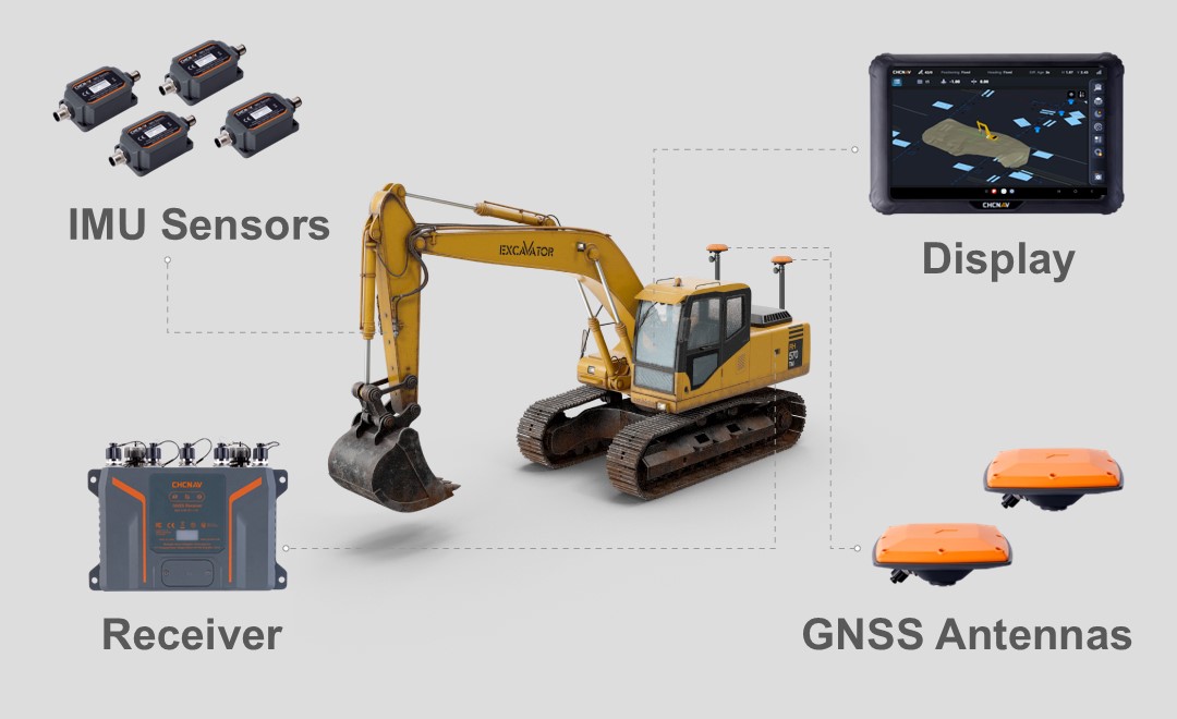
Similar integration principles are applied by machine control system manufacturers across excavators, dozers, and graders. The schematic below illustrates how GNSS antennas, a receiver, an IMU, and the in-cab 3D guidance display are integrated into the excavator to provide real-time bucket positioning and excavation guidance against the design surface.
The third force is the workflow layer above the machine. For most of the past decade, the design model lived in the BIM or civil-3D environment in the office, and a paper or PDF copy went to the site superintendent. The machine on the ground knew nothing about it. Today, design surfaces and alignment files travel from design software to the machine cab without a paper step, and the as-built data from the machine flows back to the office at the end of each shift.
That round trip changes the contract. The owner can see how much of the project has been built to the design, in surveyed terms, on a daily basis. The contractor can identify variance early instead of discovering it at acceptance. The surveyor can plan verification work against the actual machine track, not against guesses. A 3D machine control system that participates in this workflow is not just a piece of cab hardware; it is the live endpoint of the digital construction loop. The next generation of systems is being built with this workflow assumption from the start.
The job site of the next five years has more sensors per machine, more machines reporting in real time, and a job-site network that ties them together. A grader carries a high-precision GNSS receiver, an integrated IMU, two slope sensors on the mouldboard, a control valve interface to the hydraulics, a cellular or radio link out to the site network, and a cab display tied to the design model. That is six or seven data streams from one machine. Multiply by ten machines on a mid-size road job and the site is generating gigabytes of positioning, hydraulic, and surface-progress data per day.
The role of the machine control system is no longer just to drive the blade against the design surface. It is to be the on-machine half of the site data system. The system needs to acquire data reliably, time-stamp it accurately, transmit it through whatever network the site has, and present a view to the operator that is simpler than the raw data, not more cluttered. The systems that handle this well let contractors run leaner crews, identify productivity bottlenecks the same week they appear, and report progress to owners with auditable accuracy. The systems that handle it poorly are the systems that get replaced.
The cloud connectivity layer also opens up cross-fleet learning. A mining operator with a hundred dozers across three pits, all reporting GNSS-tagged blade load and engine telemetry, can spot operator-training gaps, machine-wear patterns, and route inefficiencies that would have been invisible to a per-machine view. Construction contractors are beginning to ask their machine control vendors the same data-portability and integration questions that fleet operators ask of telematics vendors. That convergence is one of the next-stage shifts in the industry.
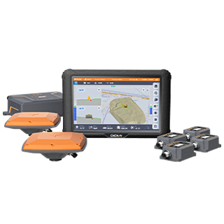
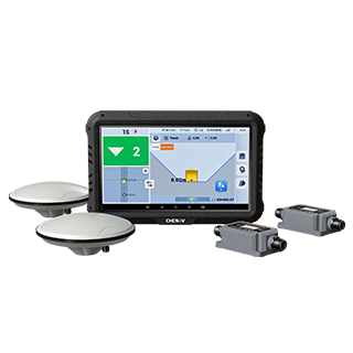
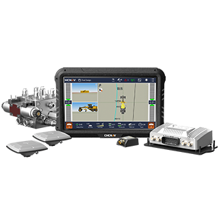
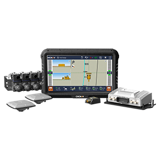
The CHC Navigation machine control portfolio is built around the three forces above. The MCNAV TX73 brings 3D machine control to excavators with GNSS plus IMU bucket positioning against the design surface. The TG63 is the 3D grade control system for graders, with real-time blade pitch and tilt control against the design model. The TD63 Pro delivers the same model-driven blade control to dozers. The EasyNAV EMG100 handles the GNSS positioning core that supplies these blade-control products with the centimeter-class fix they need to perform.
Across the lineup, the design choice is the same one the industry is making: integrate the positioning sensor, the inertial sensor, the hydraulic interface, and the workflow software at the system level rather than bolt them together at the contractor's expense. The full range sits on the CHCNAV Machine Control solution page, and the corporate industry overview walks through the use cases by segment.
The machine control system industry is at the point in its curve where the technology stack is settled, the value case is proven, and the question is no longer whether a serious contractor adopts it but how deeply. The next phase is integration: tighter automation, sharper GNSS, and a digital construction workflow that finally treats the machine and the model as one continuous system. CHC Navigation is building the next generation of machine control products to that brief. The contractors and project owners who plan for it now will spend the rest of the decade ahead of the ones who do not.
CHC Navigation (CHCNAV) develops advanced mapping, navigation, and positioning solutions designed to increase productivity and efficiency. Serving industries such as geospatial, agriculture, machine control and autonomy, CHCNAV delivers innovative technologies that empower professionals and drive industry advancement. With a global presence spanning over 140 countries and a team of more than 2,200 professionals, CHC Navigation is recognized as a leader in the geospatial industry and beyond. For more information about CHC Navigation [Huace:300627.SZ], please visit: https://machine-control.chcnav.com/about/overview.
Need a machine control system for your fleet or project?
Get in touch with our team for more information.