How Did CHCNAV Become a Leader in Positioning, Mapping, and Navigation?
2025-12-12
Building a Smarter World with Precision
Founded in 2003 in Shanghai by a small team of three, CHC Navigation (CHCNAV) has grown into a global technology leader with over 2,000 employees and operations in more than 140 countries. From the beginning, the company focused on solving a clear need: affordable, high-precision GNSS equipment to support global infrastructure expansion. By delivering reliable and accessible positioning, navigation, and mapping technologies, CHC Navigation enables professionals across industries to optimize operations, reduce costs, and adopt advanced solutions that were previously out of reach.
For us at CHCNAV, precision defines our commitment to quality and reliability. Our technology supports smarter infrastructure, efficient agriculture, safe construction, and autonomous operations. By combining innovative sensors, software, and cloud solutions, we empower users to make informed decisions and operate sustainably in an increasingly connected world.
From Startup to Global Leader
CHC Navigation's early growth was fueled by infrastructure boom and the clear opportunity to provide cost-effective GNSS solutions. In 2007, the company began its international expansion with a structured approach, deploying key personnel to engage directly with partners and end users. By maintaining a hands-on presence in new markets, CHCNAV built credibility and trust as the foundation of its success abroad.
Ownership of key technology components has been central to our competitive edge. From GNSS receivers to LiDAR scanners, inertial sensors, and integrated software platforms, CHCNAV has focused on mastering the value chain. Effective financial management has enabled continuous significant investment in R&D while keeping prices affordable for customers. These elements, combined with systematic talent development, have established CHC Navigation as a scalable, innovative, and resilient organization.
CHC Navigation Headquarters, Shanghai.
Solving Real-World Problems Across Industries
CHC Navigation addresses critical challenges in positioning, navigation, and mapping by offering complete, practical, and cost-effective solutions. Our technology spans land, airborne, and marine surveying, precision agriculture, construction machine control, and robotics enabling users to achieve tasks that were previously inaccessible due to high costs or complexity.
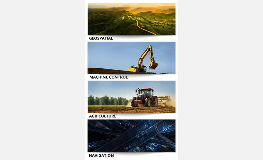
CHONAV invests heavily in R&D, maintaining a portfolio that spans four core industries:
• Geospatial: Land, airborne, and waterborne surveying and mapping systems.
• Construction & Machine Control: 3D machine guidance and automation for earthmoving and infrastructure projects.
• Agriculture: GNSS-based precision farming solutions, including auto-steering and task control.
• Navigation & OEM: Automotive and unmanned navigation, integrated GNSS/INS boards, and positioning services.
Our technology roadmap focuses on sensor integration, software ecosystem development, and accessibility through innovation. By combining GNSS, LiDAR, inertial sensors, and intelligent control, we ensure high-precision, reliable performance in diverse environments.
Our cloud-connected software enables real-time workflows from field to office, while cost-effective, integrated solutions lower the barrier to adoption for first-time users and accelerate digital transformation in traditional industries.
Autonomy and robotics represent the next frontier. From drones to unmanned vehicles and smart construction machinery, CHCNAV is developing integrated systems that automate workflows, improve productivity, and scale across industries. Proprietary RTK and PPP algorithms, combined with advanced multi-sensor fusion, ensure reliability and accuracy even in challenging environments.
Customer-Centric Approach in Practice
CHCNAV's success is built on listening to and understanding our customers. We support end users through practical engagement, structured training, and accessible technical support. Our global network of resellers and distributors ensures local, responsive, and consistent service, even in remote markets.
In infrastructure and construction, GNSS solutions, 3D mapping, and machine control systems enhance efficiency, reduce rework, and improve safety. Surveyors and engineers can capture high-resolution 3D data for topographic mapping, infrastructure inspection, and environmental monitoring. In precision agriculture, automatic guidance systems help farmers reduce input waste and streamline operations by optimizing seeding, fertilization, and harvesting. This leads to improved yields and more efficient resource use.
For aerial surveying, integrated UAV and LiDAR systems provide centimeter-level accuracy and reliable performance. In specialized sectors such as geohazards monitoring, CHCNAV offers project-based consulting and operational support to ensure that technology adoption delivers tangible benefits.
By combining innovative technology, expert support, and operational insight, CHC Navigation ensures its solutions deliver measurable results for every customer.
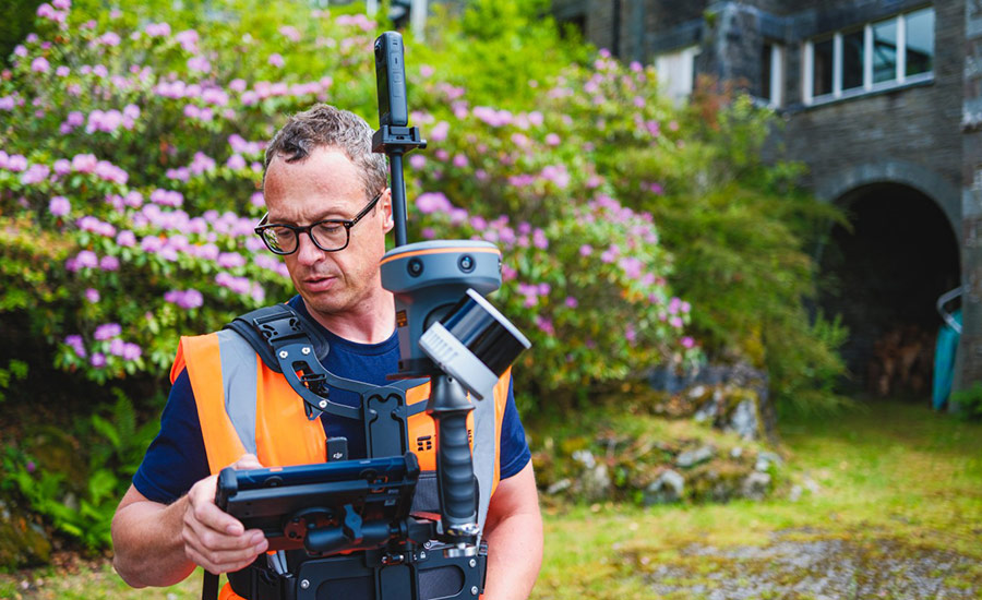
Innovation serving customer needs: the story of the RS10
Our approach to innovation is based on solving real challenges faced by our customers. The RS10 portable laser scanner + GNSS RTK is a perfect example of this philosophy in action.
During the development of the CHCNAV RS10, our team identified the main pain points encountered by surveyors: limited accuracy in complex environments, inefficient workflows requiring loop closure, and systems not designed for surveying professionals. Instead of making incremental improvements, we rethought mobile mapping from the ground up.
The breakthrough was achieved by merging SLAM and GNSS RTK technologies at the observation level. Unlike conventional systems that simply combine positioning data, the RS10 dynamically adjusts the weighting between SLAM and RTK based on environmental conditions. It ensures optimal performance in a variety of environments, from open skies to urban canyons to indoor environments.
CHCNAV RS10 - 3D Reality Capture in the field.
The innovation of the RS10 reflects our core values: customer success guides every design decision we make; self-awareness helps us identify opportunities for improvement; and open-mindedness fosters technological exploration.
The result is a system that transforms the way professionals approach complex mapping tasks. The RS10 eliminates the need to loop back, features hot-swappable batteries for uninterrupted workflow, and captures quality data in a single pass for optimal productivity. By solving real-world problems through innovation, the RS10 demonstrates CHCNAV's commitment to making high-end technology accessible, reliable, and practical for professionals around the world.
Sustainability and Social Responsibility
CHCNAV recognizes that precision technology can directly contribute to environmental sustainability. In construction, machine control and GNSS/LiDAR solutions minimize material waste and fuel consumption. Our mapping technologies support responsible land, water, and ecosystem management, including forest monitoring, reservoir maintenance, and hydrological surveys.
Within CHCNAV, we embed sustainability into our operations. Low-power electronics, responsible resource management, and ISO
14001-compliant environmental management systems help reduce our operational footprint. Collaboration with universities and research institutions through initiatives such as the Explorer Program fosters innovation and promotes knowledge sharing. Ethical procurement, transparent practices, and supplier engagement further ensure a sustainable and responsible supply chain.
Read our ESG report for more information: ESG Report
Global Reach with Local Market Insights
CHC Navigation' s international growth reflects a market-specific approach in more than 140 countries. Regional subsidiaries, local distributors, and on-site teams ensure proximity to end users, rapid feedback, and reliable support.
CHC Navigation International Partner Conference
Emerging markets are driven by infrastructure development, agricultural modernization, and digital construction adoption.
Developed markets are seeking innovative systems that combine value, performance, and localized service. CHCNAV' s accessible solutions, integrated ecosystems, and high-precision technology position the company as the trusted geospatial partner for a wide range of users. Customers benefit from cost-effective access to high-precision GNSS, LiDAR, and INS systems, cloud-based processing platforms, and multi-sensor integration, creating measurable value in every project.
CHC Navigation: A Trusted Partner in Positioning, Mapping, and Navigation
CHCNAV's journey from a three-person startup to a global technology leader reflects a consistent focus on innovation,customer-centricity, and operational excellence. By combining accessible, high-precision hardware with integrated software platforms and cloud-based workflows, CHCNAV empowers industries to improve productivity, reduce costs, and adopt advanced technology safely and efficiently.
Our commitment to sustainability and responsible resource management complements our technology leadership, ensuring CHCNAV' s impact extends beyond business outcomes. By serving as the trusted positioning, mapping, and navigation partner, CHC Navigation enables customers worldwide to navigate a smarter, safer, and more sustainable future.
____
About CHC Navigation
CHC Navigation (CHCNAV) develops advanced mapping, navigation and positioning solutions designed to increase productivity and efficiency. Serving industries such as geospatial, agriculture, construction and autonomy, CHCNAV delivers innovative technologies that empower professionals and drive industry advancement. With a global presence spanning over 140 countries and a team of more than 2,000 professionals, CHC Navigation is recognized as a leader in the geospatial industry and beyond. For more information about CHC Navigation [Huace:300627.SZ], please visit: www.chcnav.com
Engineering the Future of Precision Technology
High-performance GNSS, LiDAR, SLAM, INS, and cloud-connected software — designed to deliver professional-grade accuracy in every environment.